🌎 Nationwide Operators 📍 Multi-Site Capture ⚡ Rapid Response

Your Data Utility for Buildings & Infrastructure

We deliver site data at scale — standardized, QC’d, and ready for engineering, compliance, or development planning.
ORDER MY SITE DATA →

Choose the Deliverables You Need

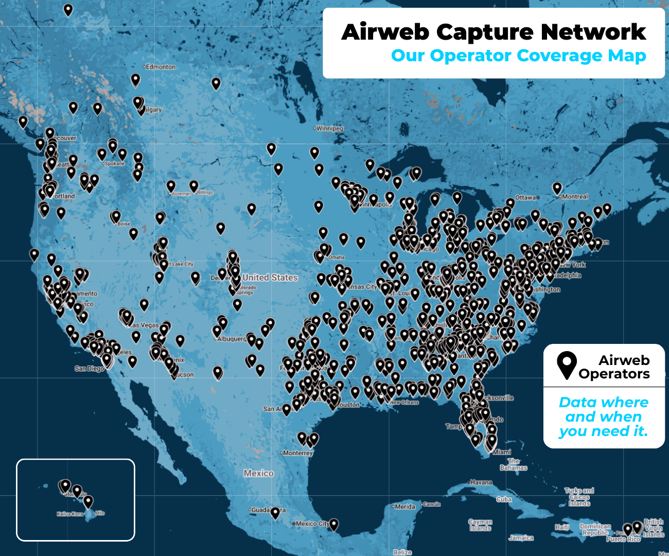
From 2D maps to 3D LiDAR scans, our operators deliver structured data you can drop directly into CAD, GIS, or BIM workflows.

Drone, Ground, & Mobile Capture
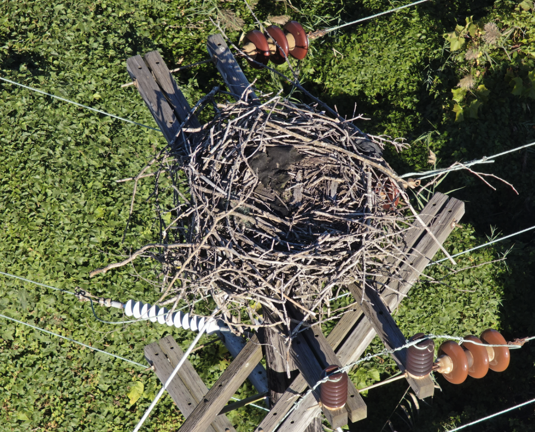
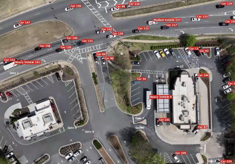
📸 RGB Imagery
High-res visuals from any angle for inspection, marketing, or documentation.
🌡️ Thermal Imagery
Pinpoint heat loss, water intrusion, or electrical faults instantly.
🌿 NDVI/Multispectral Imagery
Measure vegetation health and surface composition with spectral sensors.
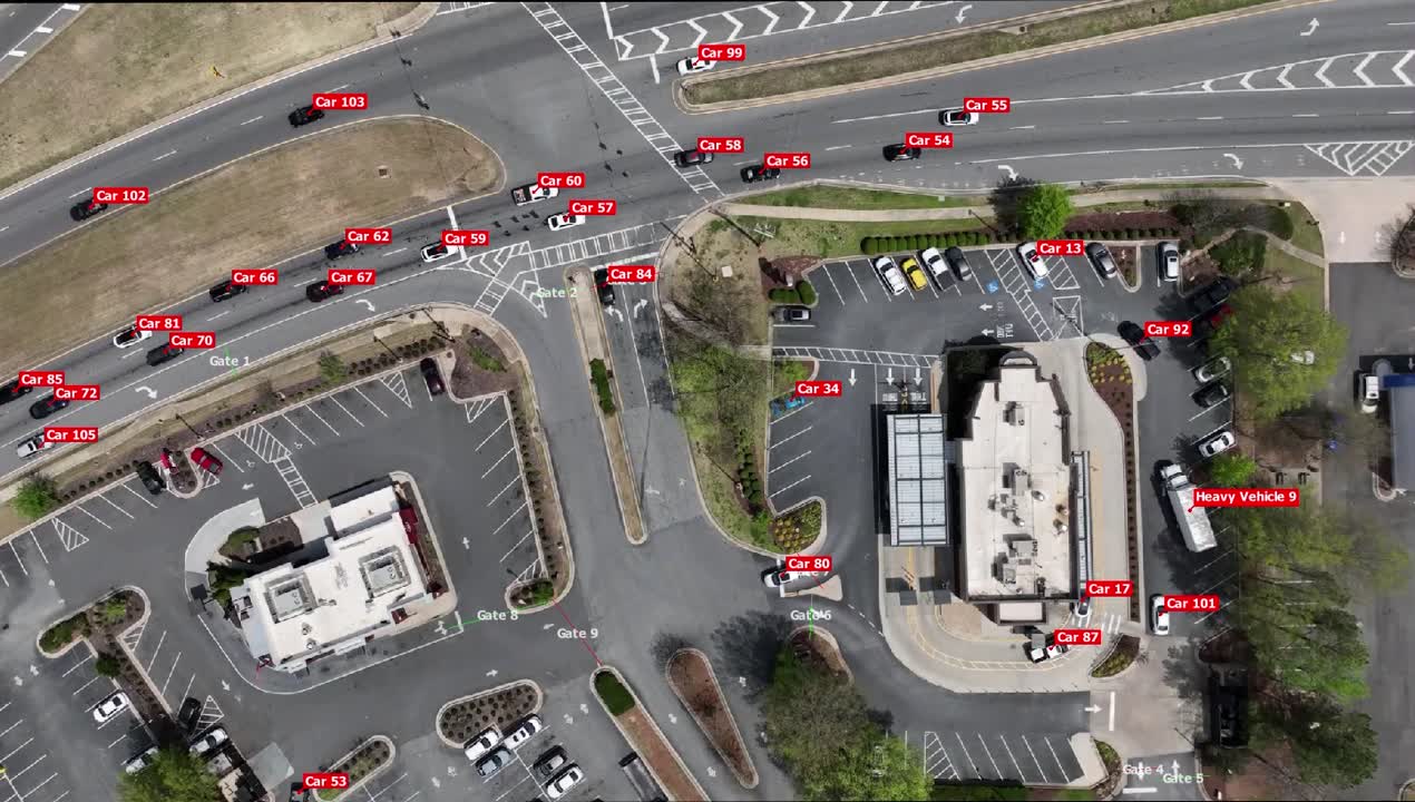
🎥 4K Video
Cinematic footage or fixed-angle views for inspections and marketing.
🌀 360-Degree Panoramic Images
Immersive stills to explore walk-throughs, signage, or utilities.
🔄 360-Degree Panoramic Videos
Full-motion immersive content for interior or exterior environments.
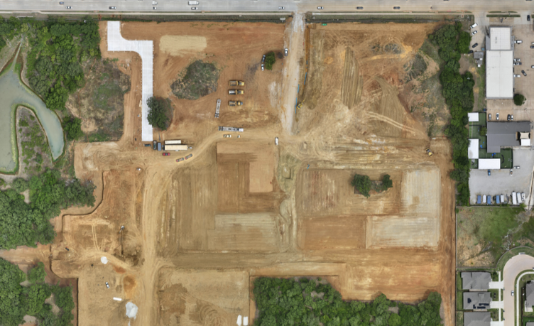
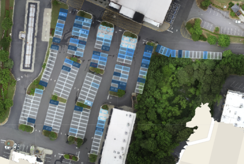
🗺️ Orthomosaic 2D Map
Geo-referenced drone imagery stitched into precise 2D maps.
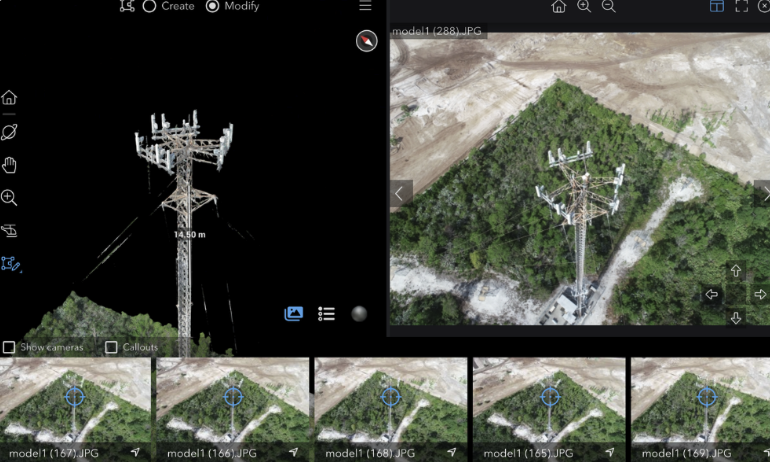
🧱 Photogrammetry 3D Point Cloud
Accurate 3D models generated from imagery—ideal for modeling and BIM.
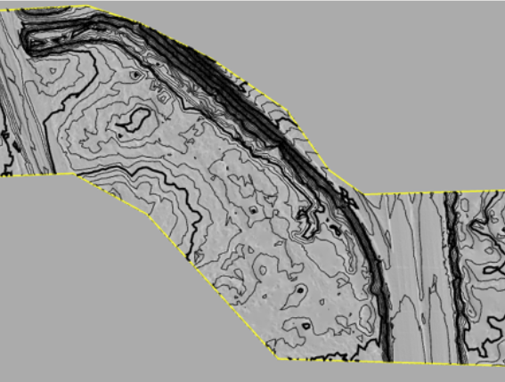
🕳️ LiDAR 3D Point Cloud
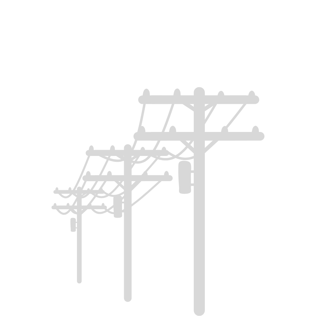
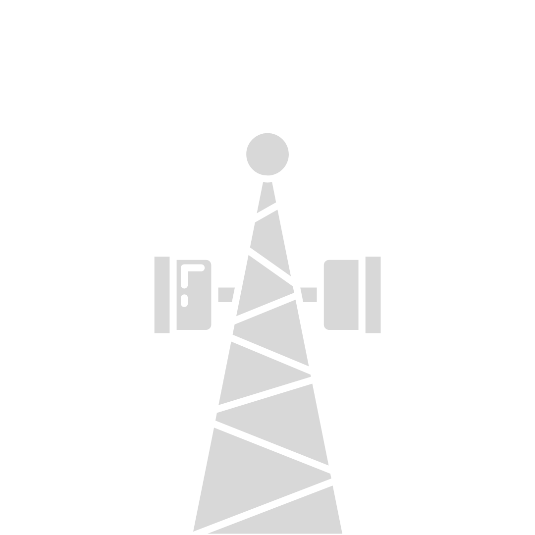
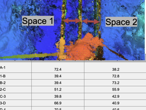
Laser-accurate 3D scans for vegetation, utilities, and built environments.
⚪ 3D Gaussian Splat Model
Lightweight 3D rendering for fast viewing, sharing, and design overlays.
📄 PDF Reports / Annotations
Visual reports with callouts, measurements, and stakeholder-ready outputs.

Solve Your Most Pressing Site Challenges

From storm damage to compliance, we capture the conditions that matter most to your operations.

Thermal Integrity Audits
Spot electrical hotspots, hidden leaks, and energy loss before they cause failures.
Order Data >
Vegetation Encroachment
Track vegetation clearance and infrastructure health with recurring LiDAR scans.
Order Data >
Wildlife Compliance
Identify nests and habitats for regulatory approval and environmental planning.
Order Data >
Remote Inspections
Digitize towers, substations, and assets for off-site engineering reviews.
Order Data >
Topographic Mapping
Precise elevation models for planning, overlays, and drainage analysis.
Order Data >
Construction Documentation
Weekly site captures to verify progress, mitigate risk, and keep stakeholders aligned.
Order Data >
2D Site Maps
Accurate orthophotos stitched from drone imagery—ideal for site planning and overlays.
Order Data >
Exterior Condition Audits
Inspect façades, roofs, and envelopes for cracks, corrosion, or structural wear.
Order Data >
Parking Studies
Analyze parking demand, flow, and utilization with AI-powered aerial imagery.
Order Data >
3D Model Simulation
Turn imagery and LiDAR into accurate 3D scenes for design and visualization.
Order Data >
Visibility Studies
Determine optimal pylon height, signage placement, and line-of-sight with sky-ground site data.
Order Data >
Traffic Studies
Classify vehicles, pedestrians, and flow patterns to optimize safety and planning.
Order Data >

Plug Our Data Directly Into Your Workflow

From CAD to AI platforms, our deliverables integrate seamlessly with your existing software stack.

Move Your Projects Forward

Airweb Digital offers an end-to-end suite of drone services tailored for commercial developments across the United States. Our network of 3,000 expert drone pilots provides national coverage and unmatched scalability for every project.
CAPTURE BEFORE BUILDING BEGINS

Pre-Construction

Set your project up for success with detailed site maps, custom planning reports, and high-quality drone imagery.
DOCUMENT PROGRESS WHILE YOU'RE BUILDING

Construction Documentation

Track progress with regular, high-resolution documentation to ensure alignment with timelines and goals.
SEE WHAT YOU COULDN'T BEFORE

Visual Inspections

Ensure safety and compliance with visual and thermal inspections, tailored for complex sites.
PLAN BETTER WITH THE FULL PICTURE

Digital Twins

Transform physical spaces into digital replicas for planning, collaboration, and analysis.

Our Services — Reality Data, Ready for Your Platforms

- Drone-Based Capture – LiDAR, RGB, Thermal, Photogrammetry

- Ground-Based Capture – Tripod LiDAR and high-resolution photogrammetry

- Mobile Mapping – Vehicle-mounted LiDAR and 360 imagery

- Data Delivery – Ortho maps, point clouds, 3D models, digital twins, and raw datasets

- AI & BIM Integration – All deliverables QC’d, georeferenced, and formatted for your systems (Autodesk, Procore, Cupix, or custom AI pipelines)

SCHEDULE CAPTURE MISSION >
“Airweb Digital has done a great job for us. Always quick to respond and easy to collaborate with. They bring ideas to the table that we haven't considered, making our job easier.”
Kristen H.
Construction Project Manager

Tired of These Project Killers?

"We don't know what's happening on our sites until it's too late."

"We spend way too much on travel and labor for inspections."

"Our data lives in too many places, and none of it talks to each other."

SCHEDULE CAPTURE MISSION >
  • We’ve heard it all. That’s why we built Airweb to solve the real issues:

  • ✅ Reduce repeat site visits

  • ✅ Cut inspection costs by up to 80%

  • ✅ Get site data delivered directly into your systems

  • ✅ Make faster, smarter decisions

You Don’t Need a Drone Pilot - You Need a Deliverable.

We handle all the logistics — from planning and permits to flying and delivery. All you have to do is focus on your core.

1. Tell us your asset or site list
2. We fly and process your data
3. You get accurate maps, visuals, models, and reports
GET STARTED >

Ready to integrate drones into your projects?

Download the Drone Integration Blueprint now and discover how to save time, cut costs, and boost efficiency with drones.

get my free blueprint

Airweb Digital makes site intelligence as simple as flipping a switch. One request in — clean data out.

We will be at ITS World Congress in Atlanta, GA - August 24